Wildfire Cameras
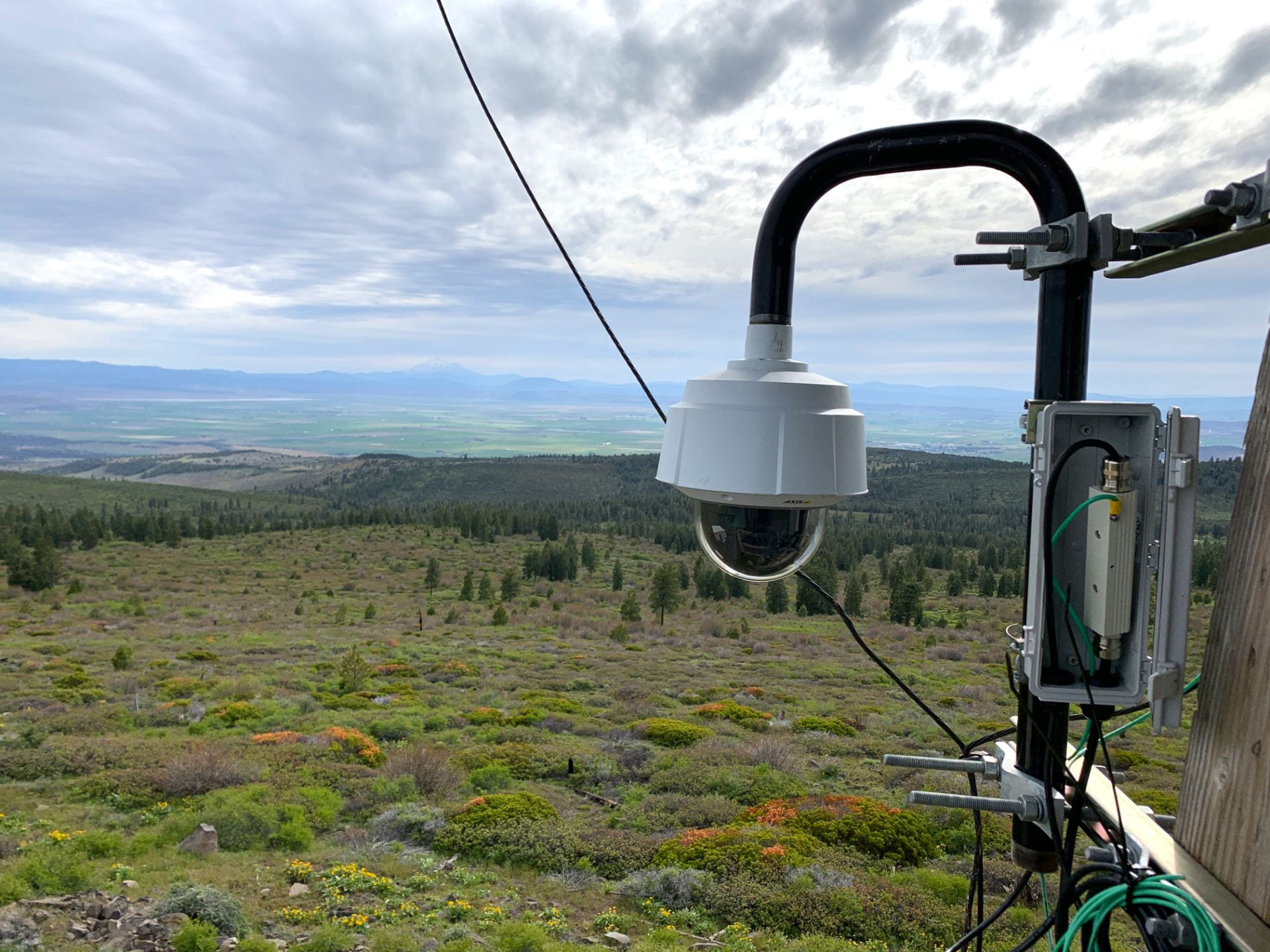
A 21st Century Firespotting SystemThe Oregon Hazards Lab operates a high-speed camera network that gives firefighters a new way to spot and track wildfires. Cameras are typically installed on top of tall mountains or high-rise buildings with 360-degree views of the surrounding landscape. Each camera can zoom, rotate, and tilt, enabling fire managers to watch the landscape, fire behavior, and weather in real-time or later through time-lapse footage. The camera network is jointly operated by the Oregon Hazards Lab; the University of Nevada, Reno; and the University of California, San Diego. With dozens of cameras in Oregon and thousands in the Western United States, this is the largest wildfire camera network in the world.

There are currently 45 wildfire cameras in Oregon, and we plan to operate 75 cameras across the state by late 2025. These cameras help firefighters:
-
- Discover, locate, and confirm fire ignition
- Quickly scale fire resources up or down
- Monitor fire behavior through containment
- Improve evacuations through enhanced situational awareness
The increased situational awareness provided by wildfire cameras has many benefits. Fire managers can confirm 911 calls by reviewing camera footage instead of dispatching human resources or aviation to do reconnaissance. Not only is this safer and less expensive, but it preserved limited resources that may be needed elsewhere. Likewise, firefighters can also monitor prescribed fires and utility companies can monitor their resources during red flag days or firestorms.
Artificial Intelligence for Wildfire Detection
Our wildfire detection cameras are now powered by ALERTWest, a technology platform from DigitalPath. This platform uses artificial intelligence to enable rapid wildfire detection. AI technology pull camera feeds from cloud servers and scan images for new ignitions using wildfire detection algorithms. If it spots a fire, it will alert dispatch centers. Dispatchers will then confirm that a fire has been detected before alerting responding agencies. Fire managers in Oregon can begin receiving automated alerts during the 2024 fire season.
Wildfire Cameras in the Rogue Valley
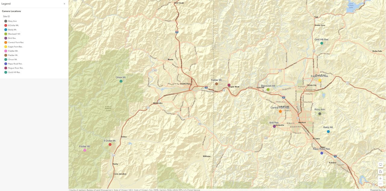
The Oregon Hazards Lab has partnered with the Rogue Valley Council of Governments to apply for a grant from the Federal Emergency Management Agency. This funding would enable us to install twelve additional wildfire cameras in the Rogue Valley in 2024. These cameras will complement existing wildfire cameras in the region. Together, they will provide a comprehensive viewshed of this high-risk corridor, including Medford, Grants Pass, Cave Junction, and Eagle Point.

Learning More About Wildfire Cameras
How do wildfire detection cameras work?
These high-definition pan-tilt-zoom cameras have near-infrared capabilities and can zoom up to 32 times. They have a range of up to 40 miles in the daytime and 60 to 80 miles at night. Any member of the public can view still images that change every few seconds and watch time-lapse images on demand. Firefighters with log-in credentials can control the cameras and watch live video feeds in real-time. ALERTWest’s artificial intelligence capabilities enable early fire detection and can interface with other technologies to predict fire behavior.
Who can use the wildfire cameras?
ALERTWest is a high-bandwidth distributed IP-based system that enables anyone with internet to access its cameras on any device 24/7. Anyone can view its public-facing video feeds for greater situational awareness. The interface has the same touch and feel in Nevada, California, Idaho, Oregon, and Washington, easing use for stakeholders across the western United States.
Firefighters can also obtain secure web access for direct camera control. Over 200 Oregonians from more than 50 different agencies have log-in credentials. These users include the American Red Cross, the Bureau of Land Management, the Oregon Department of Forestry, the U.S. Forest Service, the U.S. Army Corps of Engineers, NOAA, Oregon Department of Transportation, Oregon State Police, Oregon State Fire Marshall, local fire departments, local governments, and utilities. To request camera control log-in credentials, please email us at wildfirehelp@uoregon.edu.
Who are our partners in operating the wildfire camera network?
The camera network is cooperatively managed by the University of Oregon; the University of Nevada, Reno; and the University of California, San Diego. We have contracted the private technology platform ALERTWest to host our cameras. We also collaborate with diverse federal, state, and county agencies; utilities; and local stakeholders in leveraging funding and installing cameras. Our Oregon sponsors and partners include the State of Oregon, the Bureau of Land Management, the Oregon Department of Transportation, Eugene Water and Electric Board, Rogue Valley Council of Governments, Lane Council of Governments, Lane County Educational Service District, Lane County Sheriff’s Office, Klamath Falls Community College, KATU2, Elevate Technology Group, Rogue Broadband, and Illinois Valley Data Center.
How does this camera network interface with others in the region?
The Oregon Department of Forestry and Portland General Electric operate two similar and complementary wildfire camera networks in Oregon. However, our wildfire camera network is the only one with publicly accessible footage. As co-chairs of the Oregon Wildfire Detection Camera Interoperability Committee, we also work closely with the Oregon Department of Forestry and Portland General Electric to ensure our wildfire cameras are interoperable with other similar systems in the state and that we are successfully coordinating with our partners.
How do wildfire cameras support a multi-hazards observing network?
The Oregon Hazards Lab is increasingly co-locating wildfire detection cameras and Pacific Northwest Seismic Network seismic monitoring stations. The high-speed telemetry backbone needed to transmit images and videos in real-time can be leveraged to deliver real-time, state-wide monitoring for a multi-hazard system. Because wildfire cameras already require high bandwidth, this network is easily expandable to other low-bandwidth sensors like seismometers for the ShakeAlert Earthquake Early Warning System. Co-locating sites provides mutual benefits. Communities face a multitude of hazards, which cannot be addressed by a single-hazard detection system. Because monitoring networks are expensive and difficult to maintain, co-locating sites is both cost-effective and improves statewide resiliency for a variety of natural hazards. Seismic stations can take advantage of the cameras’ solar panels and high-bandwidth telemetry, whereas fire cameras benefit from seismic sites’ high standards for constant up-time, automatic failover, and redundancy. As of April 2023, there are seven sites which host both a wildfire camera and seismic site.
